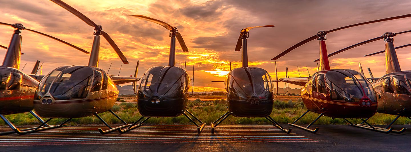
Commercial Aerial Surveying and Imaging Services in Memphis
Precision Aerial Perspective for Tennessee
Memphis Helicopter Charters delivers comprehensive aerial survey solutions across Tennessee, encompassing specialized operations such as magnetometer and electromagnetic surveys, LiDAR data acquisition, and advanced GIS mapping. Leveraging the unique low-altitude flight and precision hover capabilities inherent to rotary-wing aircraft, we provide a broad spectrum of adaptable options for critical data collection. Furthermore, our aerial filming services offer specialized configurations for high-definition cinematography and professional photography, including provisions for gyro-stabilized camera systems or aircraft modification for direct handheld operations. We are dedicated to furnishing unparalleled aerial imaging and remote sensing capabilities for projects throughout the Memphis area and the entire state.
Aerial
Surveys
LiDAR, GIS Maps, FLIR, HD Video & More
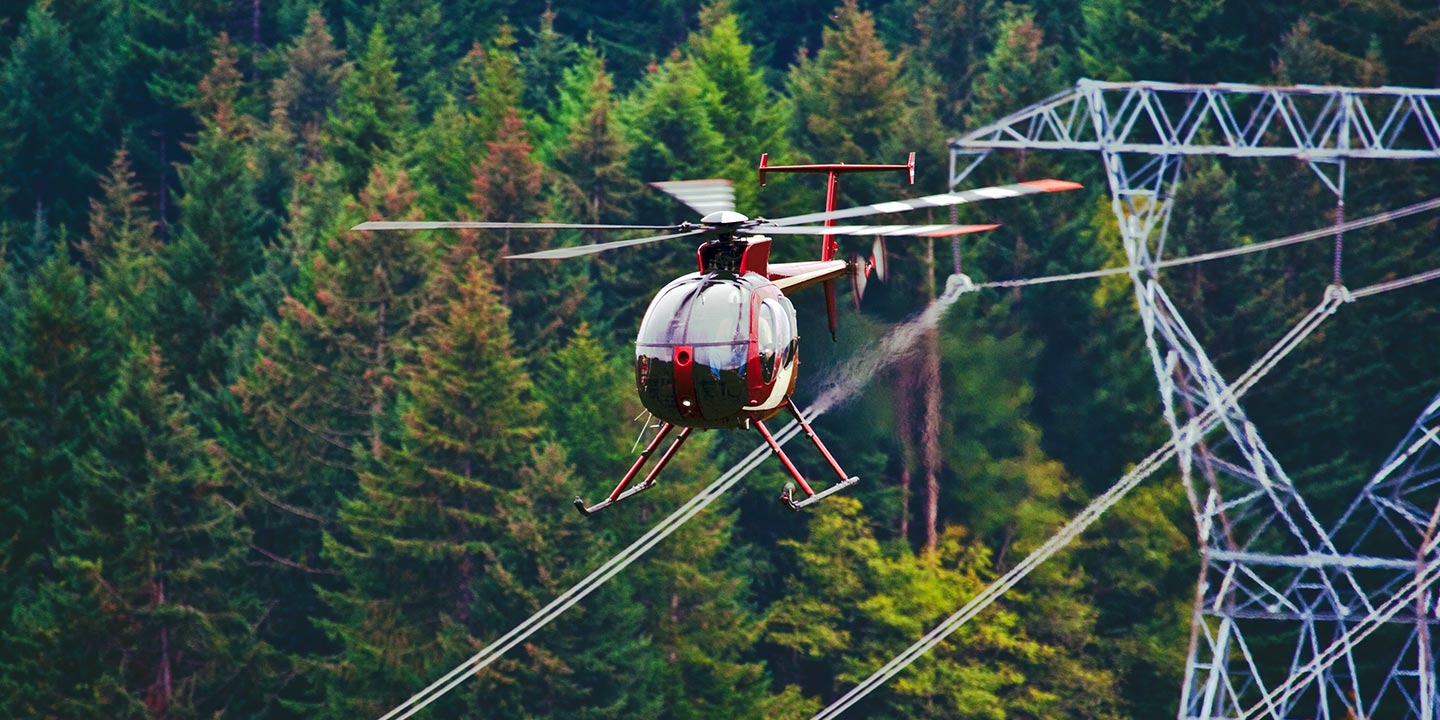
Memphis Helicopter Charters provides critical aviation support for infrastructure management, from comprehensive pipeline surveys and Right-of-Way inspections to precise transmission line monitoring and patrols. We ensure the deployment of the optimal aircraft, equipped with the necessary specialized instrumentation, to achieve rigorous project specifications and deliver accurate, actionable data for complex infrastructure assets across Tennessee.
High Tech Results
The Top Pilots in Tennessee, Today's Technology... Maximum Results.
Call 1-866-826-4826 Now!
Memphis Helicopter Charters provides the tools needed to complete your land surveys, utilizing the right equipment to provide the aerial photos that are often needed.
An effective aerial survey significantly streamlines Right-of-Way and site inspections, facilitates precise topographical data acquisition, and enables high-resolution photographic documentation for commercial development projects. Rotary-wing aircraft offer an unparalleled platform for detailed observation of the diverse Tennessee terrain, comprehensive pipeline leak detection, and proactive identification of transmission line anomalies, along with thorough property imaging. Memphis Helicopter Charters specializes in developing highly customized photographic and remote sensing operations, meticulously engineered to optimize both technical precision and financial efficiency, ensuring superior data capture and actionable results for clients in the Memphis region and throughout the state.
The inherent operational characteristics of rotary-wing aircraft, specifically their capacity for low-altitude, slow-speed flight, render them indispensable for precise aerial surveying. Unlike fixed-wing aircraft, which are generally restricted by FAA regulations to a minimum of 1,000 feet above the highest obstacle, helicopters can operate at significantly lower altitudes. This distinct capability enables meticulous inspection of critical infrastructure and hazardous zones, providing engineers and project managers with invaluable, otherwise inaccessible perspectives for detailed assessment and informed decision-making across Tennessee.
There is no better way to conduct your visual survey, animal population counts, soil drainage analysis, ROW inspections, pipeline and transmission line inspections, and geographical surveys.
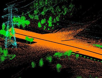
LiDAR Imaging
Light Detection and Ranging, or LiDAR, is a remote sensing method used to examine and measure Tennessee topography as well as objects, like vegetation, upon it.
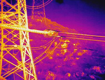
Infrared Imaging
Thermographic IR cameras are used to detect radiation in the long-infrared range of the electromagnetic spectrum and produce images of that radiation, called thermograms.
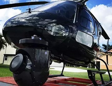
HD Video Gimbal Capture
Modern HD and 4K cameras can be mounted to helicopters, using the proper STCs, with a gimbal to stabilize photos & videos for detailed results.
Advanced Aerial Cinematography and Visual Documentation
For expert camera work in the Memphis Sky
Get a Fast, free QuoteMemphis Aerial Cinematography
Memphis Helicopter Charters provides comprehensive access to advanced rotary-wing aircraft and specialized equipment essential for professional-grade aerial cinematography across Tennessee. We facilitate custom aerial shoots utilizing industry-leading gyro-stabilized camera mounts, including systems from Tyler Mounts, Wescam, Cineflex, Pictorvision, and SpaceCam. These are integrated with high-performance specialty cameras such as Cineflex HD, RED Epic, and Arri Alexa, alongside capabilities for 3D and experimental camera configurations. Our operational scope supports a full spectrum of production requirements, from dynamic air-to-air sequences to precise ground-to-air perspectives, ensuring all cinematic objectives are met. We emphasize seamless coordination with aerial Directors of Photography and production directors to achieve specific visual results. Specializing in both still and motion aerial photography, Memphis Helicopter Charters is equipped to support nearly every media-related operation within Tennessee. This includes feature films, television productions, documentaries, high-impact promotional videos, commercials, and the provision of aerial platforms for relief work by news organizations. Furthermore, we facilitate comprehensive coverage for significant historical and major sporting events, deploying a diverse array of helicopters tailored to specific mission profiles.
Call Us Today at 1-866-826-4826 for a Free Quote
Contact Us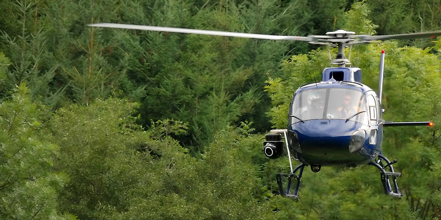
Aerial Photos
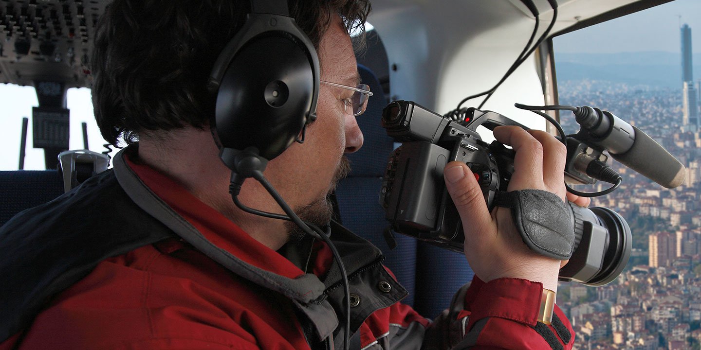
Hand-held or Mounted OpTions in Memphis
We will help you get the right equipment for your aerial photography project! Call 1-866-826-4826 today to get a fast, free quote.
The Most Options for Photography
The expansive and intricate landscapes of Tennessee, from its urban centers to its natural features, are most comprehensively documented and visually impactful when captured from an aerial perspective. Memphis Helicopter Charters facilitates bespoke aerial photography missions engineered to meet the precise visual objectives of professional clients. We are equipped to provide cost-effective solutions for capturing high-quality aerial imagery throughout Tennessee. Many rotary-wing aircraft can be configured with doors removed to accommodate handheld photographic operations, providing dynamic flexibility for diverse projects. For applications demanding enhanced stability and precision, we strongly recommend inquiring about our advanced gyro-stabilized camera mount options, which provide superior imaging platforms for critical assignments.
Superior Service
Every one of our customers gets a dedicated helicopter expert to assist with flight plans, tech loadouts, production logistics, project schedules, and other demands.
Over 500 Aircraft
Our network of direct air partners extends well beyond Memphis, Tennessee. This allows us to offer a wide range of solutions for even the most sophisticated projects.
The Best Equipment
From high-tech sensors like LiDAR, FLIR, and GIS to HD cameras and movie production gimbals, we're here to make your job as easy as possible.